The 14 Kilometres
The Strait of Gibraltar — migration, surveillance, history, and the narrowest gap between two continents
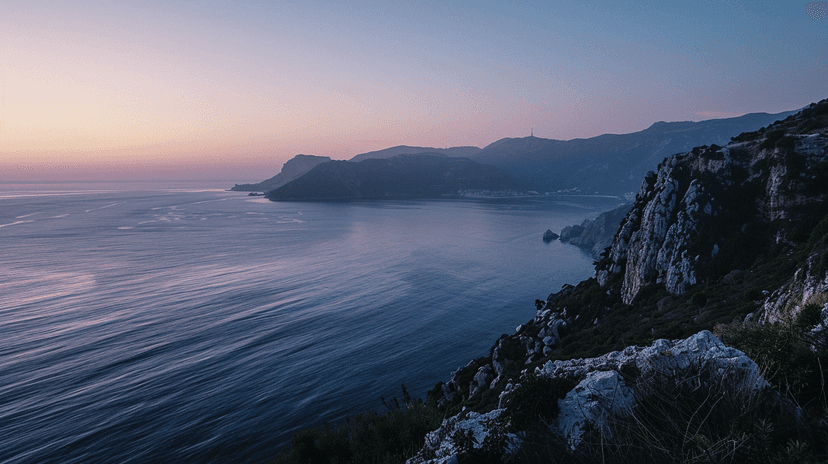
The distance from Point Cires on the Moroccan coast to Point Marroquí on the Spanish coast is 14.3 kilometres. On clear days — and most days are clear — you can see the other continent. The buildings of Tarifa are visible from Tangier. The lighthouse at Cap Spartel looks directly at the coast of Andalusia.
The strait has been crossed for millennia. The Phoenicians sailed through it. The Romans called it Fretum Herculeum — the Strait of Hercules. In 711, Tariq ibn Ziyad crossed from Morocco to Spain with an army that would conquer most of the Iberian Peninsula. The rock where he landed — Jebel Tariq — became Gibraltar. The crossing that created al-Andalus took less than a day.
Today the strait carries over 100,000 vessel transits per year — one of the busiest shipping lanes in the world. Container ships, oil tankers, bulk carriers, naval vessels, and ferries navigate a channel where the current runs at up to 4 knots and the traffic flows in two directions. The Tangier Med port — opened in 2007 on the strait's southern shore — is now the largest container port in Africa and the Mediterranean.
The strait is also a border. Fortress Europe meets Africa at this 14-kilometre gap. SIVE — Spain's Integrated External Surveillance System — monitors the water with radar, infrared cameras, and patrol boats. Frontex operates in the area. Despite the surveillance, crossings continue — in pateras (small boats), in rubber dinghies, by swimming, hidden in vehicles on the ferries.
The human cost is documented. The International Organization for Migration estimates that over 2,000 people have died attempting the crossing since records began in the 1990s. The actual number is certainly higher — bodies lost in the current are carried into the Atlantic and never recovered.
Fourteen kilometres. You can see the other side. The distance is nothing. The gap is everything.
Explore the full interactive module — with strait geography, shipping data, migration statistics, and the historical crossings mapped — at Dancing with Lions: https://www.dancingwiththelions.com/data/the-14-kilometres
Interactive Module
Data and visualisation by Dancing with Lions