The Vertical Migration
From desert floor to mountain pass — the ecological transect of the High Atlas
The transect begins on the Haouz Plain at 450 metres. Marrakech sits in a semi-arid zone — olive groves, citrus orchards, and irrigated agriculture sustained by Atlas snowmelt. Average rainfall is 250mm per year. The vegetation is Mediterranean scrub and cultivated land.
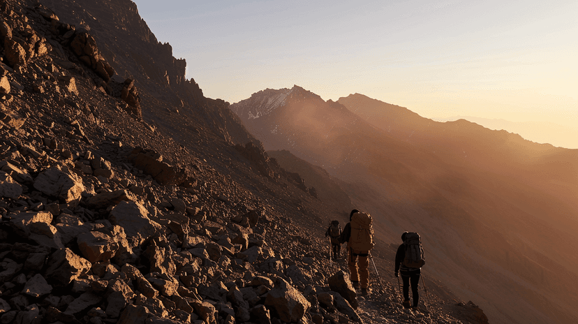
The ascent to Tizi n'Tichka — at 2,260 metres, the highest paved pass in Morocco — takes two hours and crosses every zone. Below 1,000 metres: argan trees, cactus, and dry scrubland. Between 1,000 and 1,800 metres: juniper, holm oak, and terraced agriculture — walnuts, almonds, cherries, and barley cultivated on narrow mountain terraces irrigated by gravity-fed channels.
Above 1,800 metres: the tree line shifts to Atlas cedar and Aleppo pine. The air cools. Rainfall increases. Snow falls above 2,000 metres in winter. The villages here — stone-built, flat-roofed, clustered on slopes above the valley floor — are architecturally distinct from the lowlands. The building material shifts from pisé to stone as you climb.
The pass itself is bare rock and scrub — too high for trees, too exposed for cultivation. Temperatures drop below freezing on winter nights. The road — built by the French in the 1930s — winds through 60 kilometres of switchbacks. Trucks, buses, and tourist vehicles share a two-lane road with donkeys and shepherds.
The descent to the south is abrupt. The rain shadow takes effect immediately. Within 30 kilometres of the pass, the landscape transforms from green mountain to red desert. Ouarzazate at 1,160 metres receives less than 100mm of rainfall. The vegetation is sparse — a few irrigated palms along the riverbeds, otherwise bare rock and gravel.
The Draa Valley floor — at 700 metres — is full desert. Date palms survive on the last water from the Atlas. The temperature range is extreme — 50°C in summer, below freezing in winter nights. The entire transect — from irrigated plain to alpine pass to desert floor — covers less than 200 kilometres. The Atlas compresses what other continents spread across thousands.
Explore the full interactive module — with the elevation profile, vegetation zones, and the ecological gradient mapped — at Dancing with Lions: https://www.dancingwiththelions.com/data/the-vertical-migration
Interactive Module
Data and visualisation by Dancing with Lions