The mountains are not standing still. They are rising, centimetre by centimetre, as Africa pushes north into Europe. The collision that built the Alps is building the Atlas too. The process is slow enough to be invisible and powerful enough to be unstoppable, which is a combination that geology specialises in.
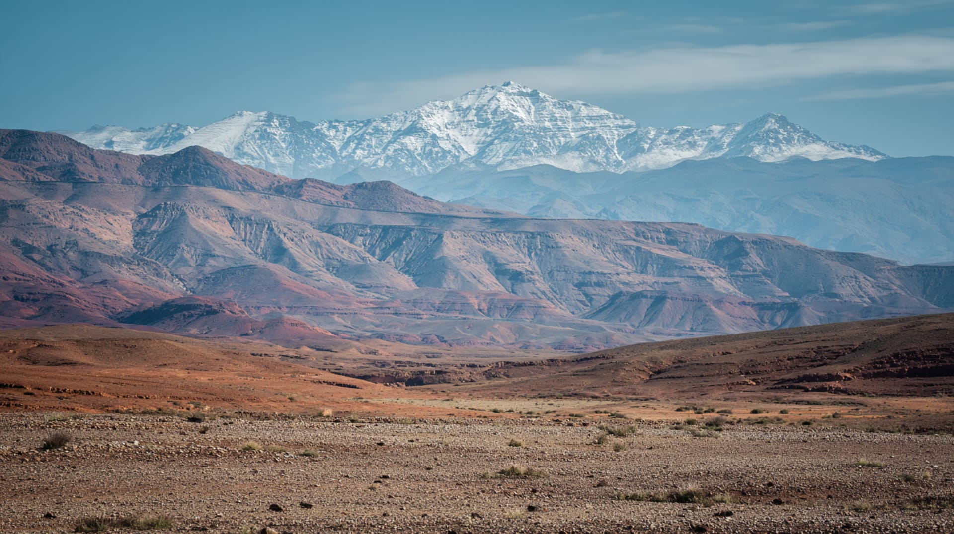
From the Agafay plateau, the High Atlas fills the southern horizon like a jagged wound in the sky. On clear winter days, snow covers the highest peaks — Toubkal at 4,167 metres, M'Goun at 4,071 — and the light turns them pink at dawn and violet at dusk. They look eternal. They are not. They are still being made.
The story begins 300 million years ago, when the first phase of mountain building created the Anti-Atlas. During the Mesozoic — the age of dinosaurs — the crust stretched and thinned, opening a rift valley that filled with sediment. For millions of years, this was the floor of a shallow sea. The rocks that form the High Atlas peaks were deposited underwater, which means that the summit of Toubkal is made of material that was once on the ocean floor. The mountain remembers being flat.
Around 180 million years ago, dinosaurs walked here. The Atlasaurus — named for these mountains — was a 15-metre sauropod whose bones were found near Azilal. Dinosaur footprints are preserved in the limestone of the central High Atlas, visible to anyone who knows where to look and invisible to everyone who doesn't, which is most people.
The collision proper began 65 million years ago, when Africa's tectonic plate began its slow, implacable push northward. The sedimentary layers buckled. The fault lines activated. The Atlas rose — and continues to rise, at a rate of roughly 1-2 millimetres per year. The 2004 Al Hoceima earthquake was a reminder that the geology is active. The mountains are not scenery. They are a process.
The Agafay sits at the boundary between the plains and the mountains — the exact point where the flat world ends and the crumpled world begins. The plateau is the collision's front porch. The rocks underfoot are the same rocks that were pushed up to form the peaks on the horizon. Same material, different altitude, different destiny. The continent is still moving. The mountains are still rising. The collision has been happening for 65 million years and is not finished, which puts most human projects into perspective.
The geology of the Atlas is visible from the Tizi n'Tichka road. Africa meeting Europe — the collision is still happening.
Tell us about your trip →The Facts
- —High Atlas formed over 300+ million years in three phases
- —Toubkal (4,167m) is highest peak in North Africa
- —Ighil m'Goun (4,071m) is second highest
- —Africa moves toward Europe at ~4mm per year
- —Same collision created the Alps, Pyrenees, and Strait of Gibraltar
- —Atlasaurus dinosaur fossils found near Azilal, ~180 million years old
- —2023 Al Haouz earthquake (magnitude 6.8) killed 3,000+ people
- —Sedimentary layers visible on mountain flanks formed underwater
- —Recent studies suggest mantle upwelling contributes to Atlas elevation
Sources
- Pennell, C.R. Morocco Since 1830. NYU Press, 2000
- Miller, Susan. A History of Modern Morocco. Cambridge University Press, 2013
- Rivet, Daniel. Le Maroc de Lyautey à Mohammed V. Denoël, 1999